


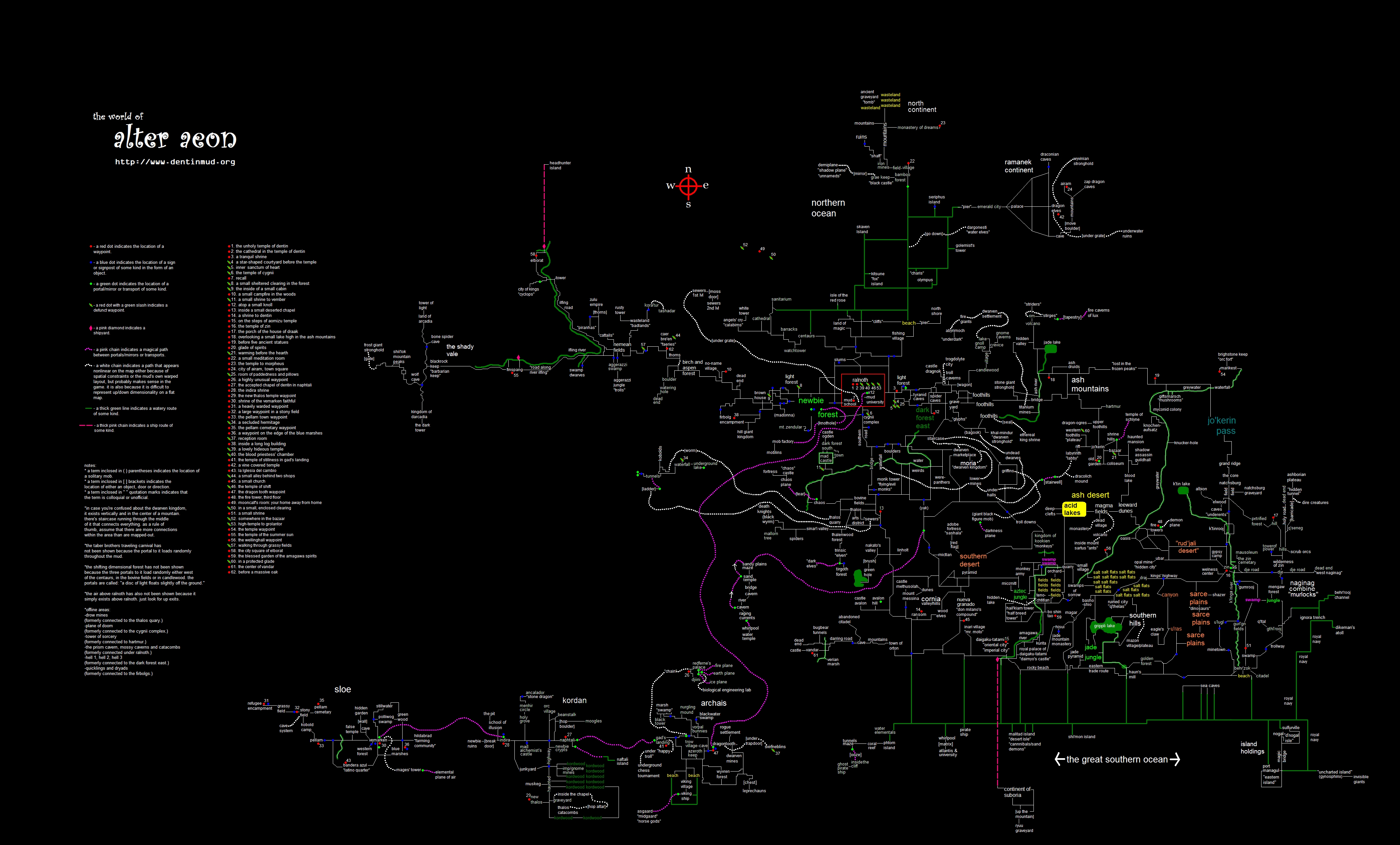
(Note - these maps unfortunately cannot be used by the blind and visually impaired. We are working on text based maps for use with readers.)
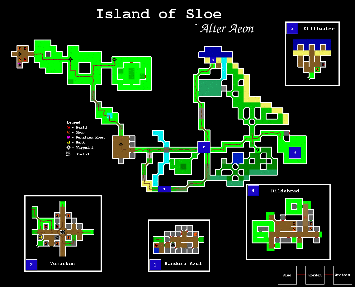
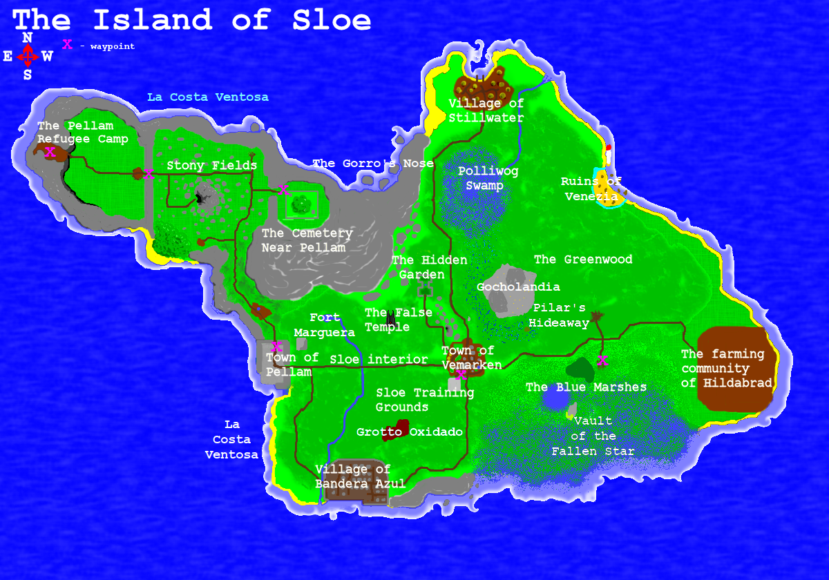
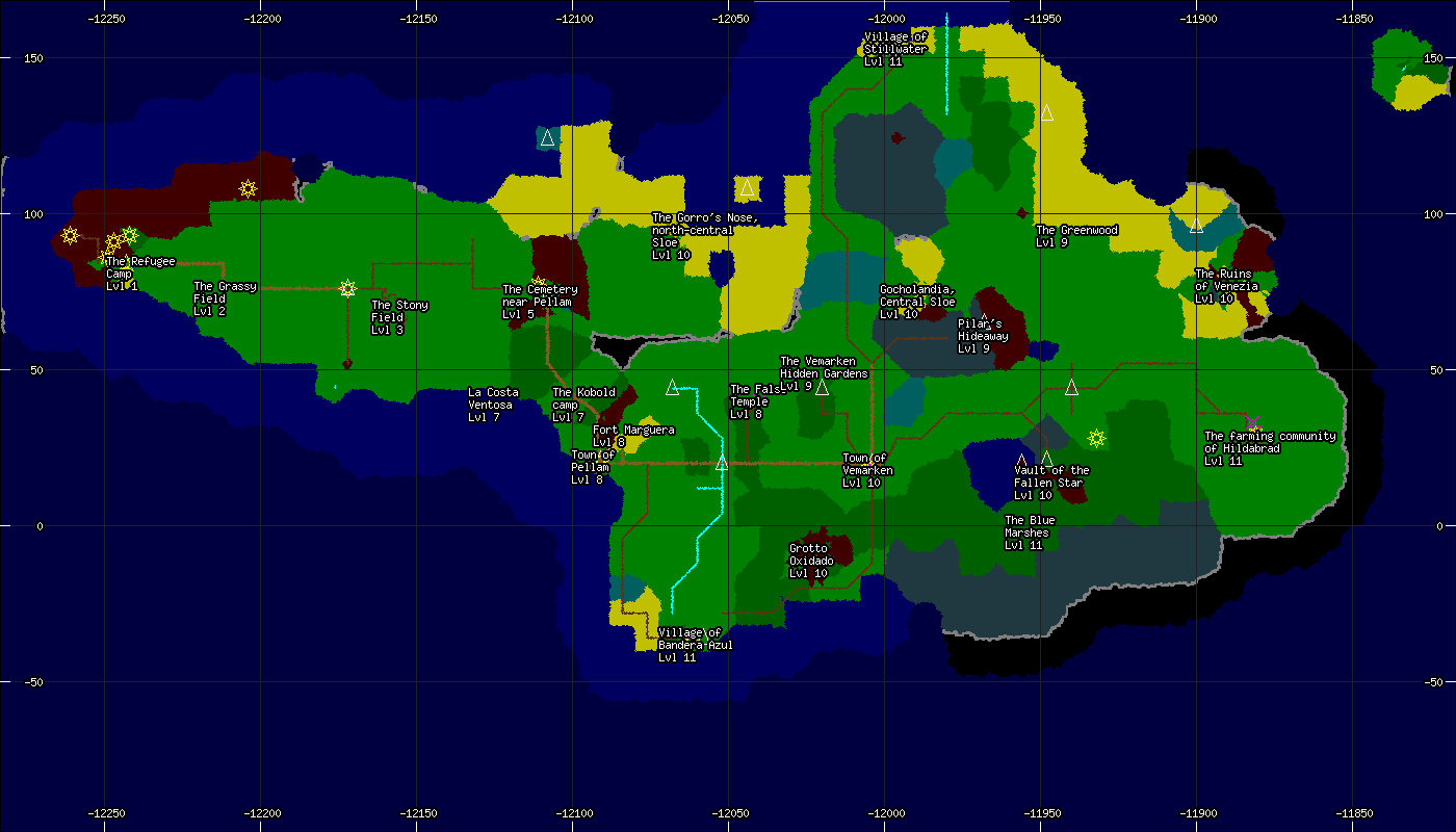
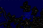
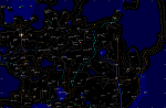
Level 1 - 15: The Island of Sloe
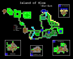


The four major towns of Vemarken, Hildabrad, Stillwater, and Bandera Azul are all shown in detail on the first map, including the location of shopkeepers, banks, and guildmasters. A portal in the town of Vemarken links to the city Indira on the Island of Kordan.
The overhead map was drawn in pieces via airship and is fairly unique as far as maps go. The trade route map was constructed using the standard directional scrying, road marking, and conventional surveying where applicable.
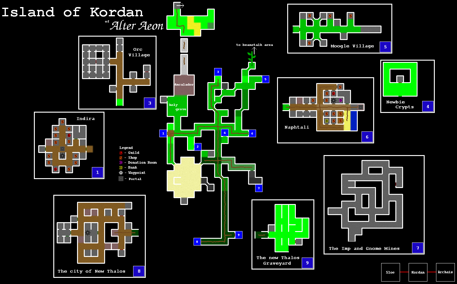
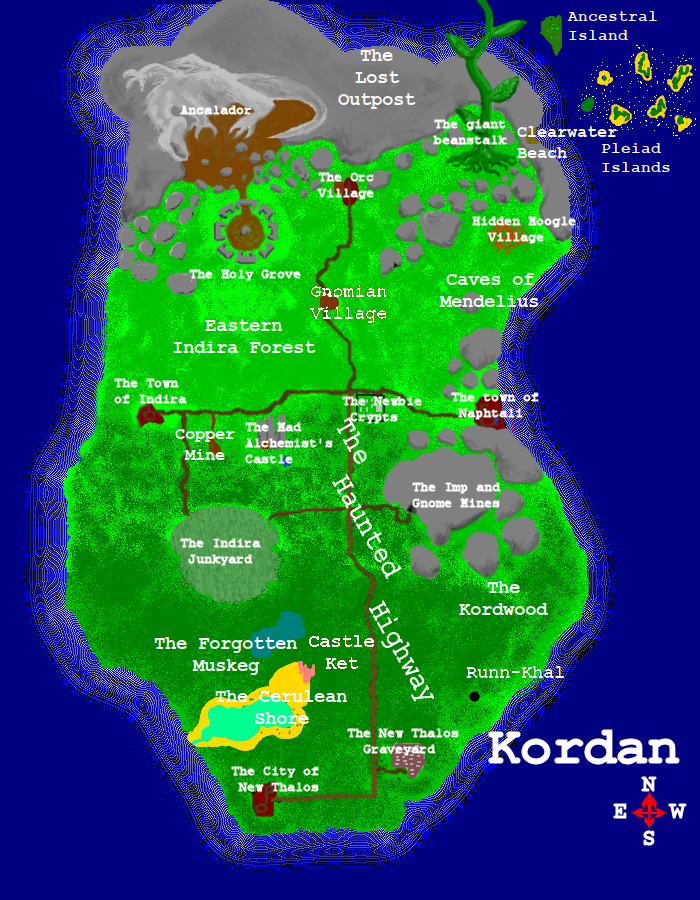
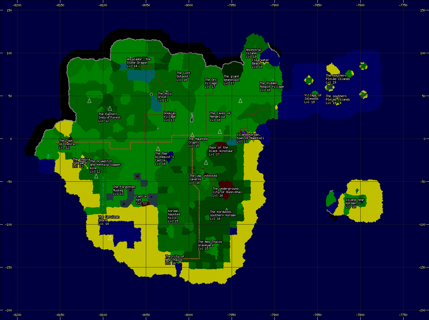
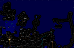
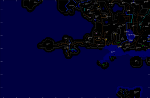
Level 10 - 20: The Island of Kordan

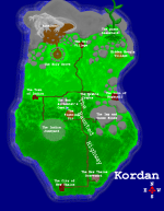
The two major towns of Indira and Naphtali are shown in detail on this map. Also included are the locations of a number of villages and graveyards, as well as what little is known about the lost city of New Thalos.
A portal in Indira links to the town of Vemarken on the Island of Sloe. A similar portal in the town of Naphtali links to the town of Gad's Landing, on the Island of Archais.
The trade route map focuses more on roads and trails and is intended for merchants, travellers, and caravans. As with all sanctioned trade route maps, its accuracy was only guaranteed for a short time after it was issued.
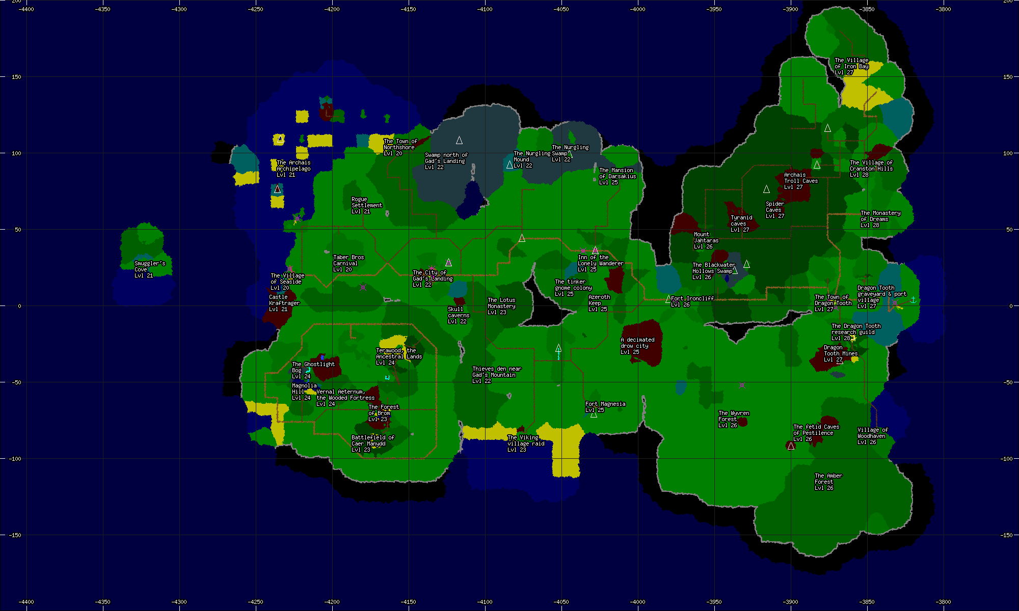
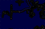
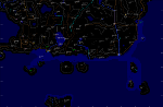
Level 15 - 29: The Island of Archais

Archais was discovered by the mage Gad Addlebrook several centuries ago as the result of an impressively failed teleport spell. The town of Gad's Landing marks approximately where the mage found himself after regaining consciousness.
This trade route map focuses more on roads and trails and is intended for merchants, travellers, and caravans. As with all sanctioned trade route maps, its accuracy was only guaranteed for a short time after it was issued.
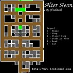
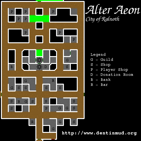
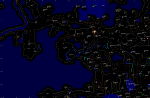
The City of Ralnoth
The Naginag Combine
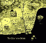
Here is an early map of the lands and local trade routes near the Combine, as created by the Naginag chamber of commerce. This map was published without restriction, but was not available in the Ralnoth region until recently.
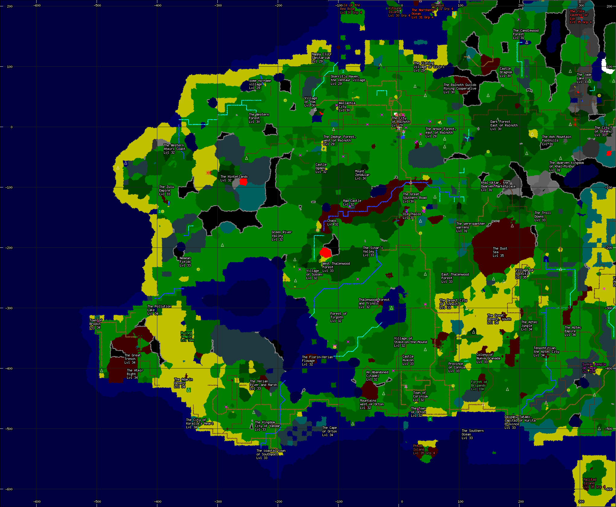
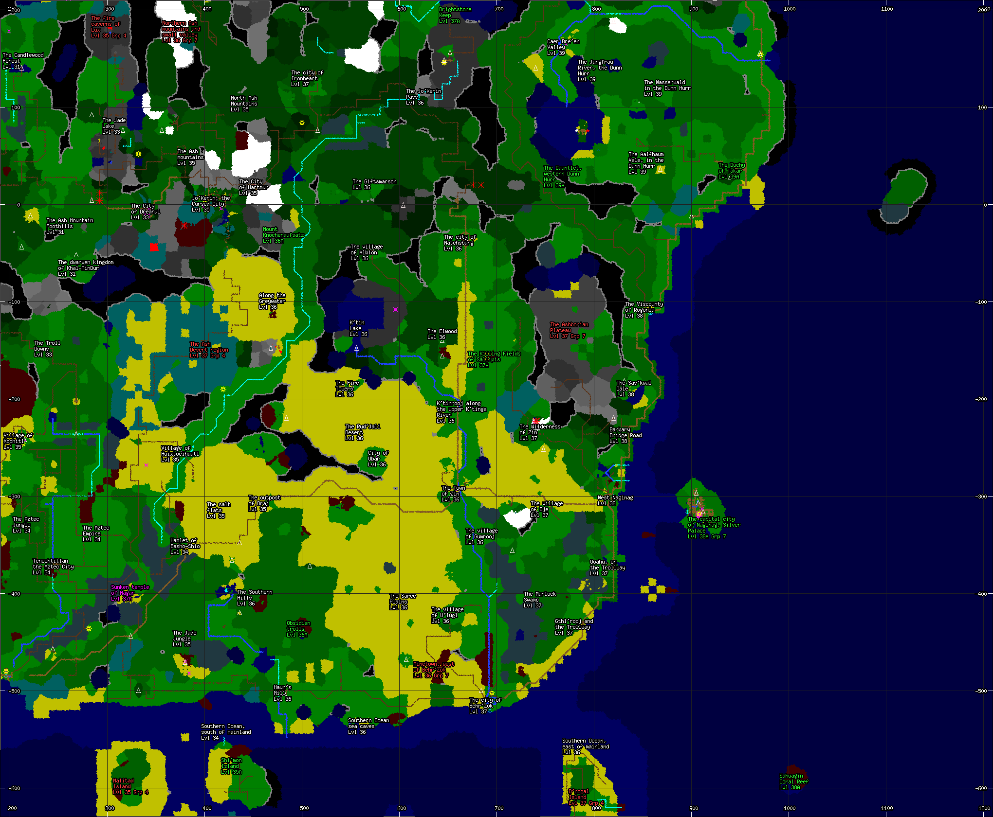
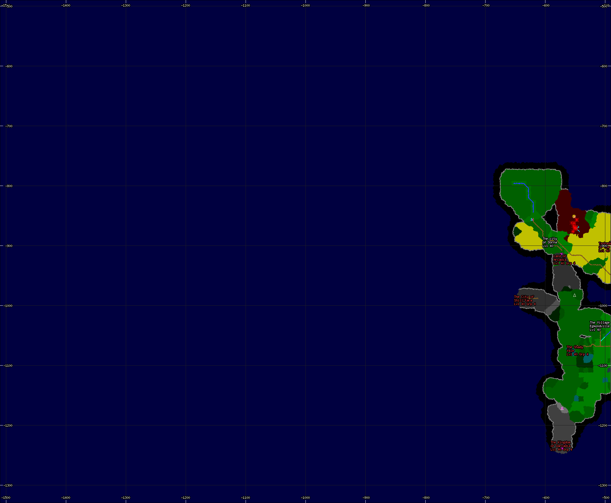
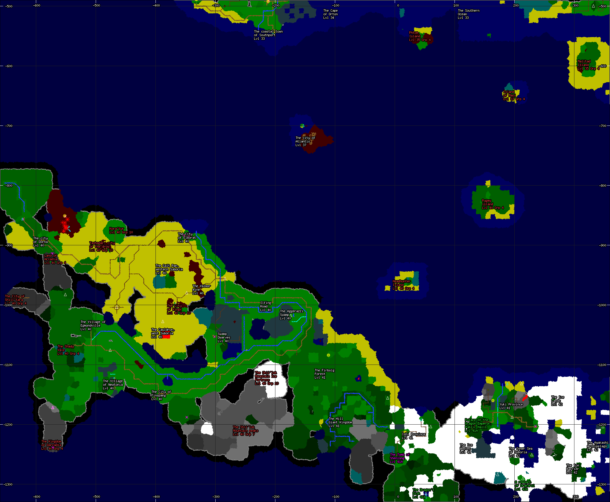
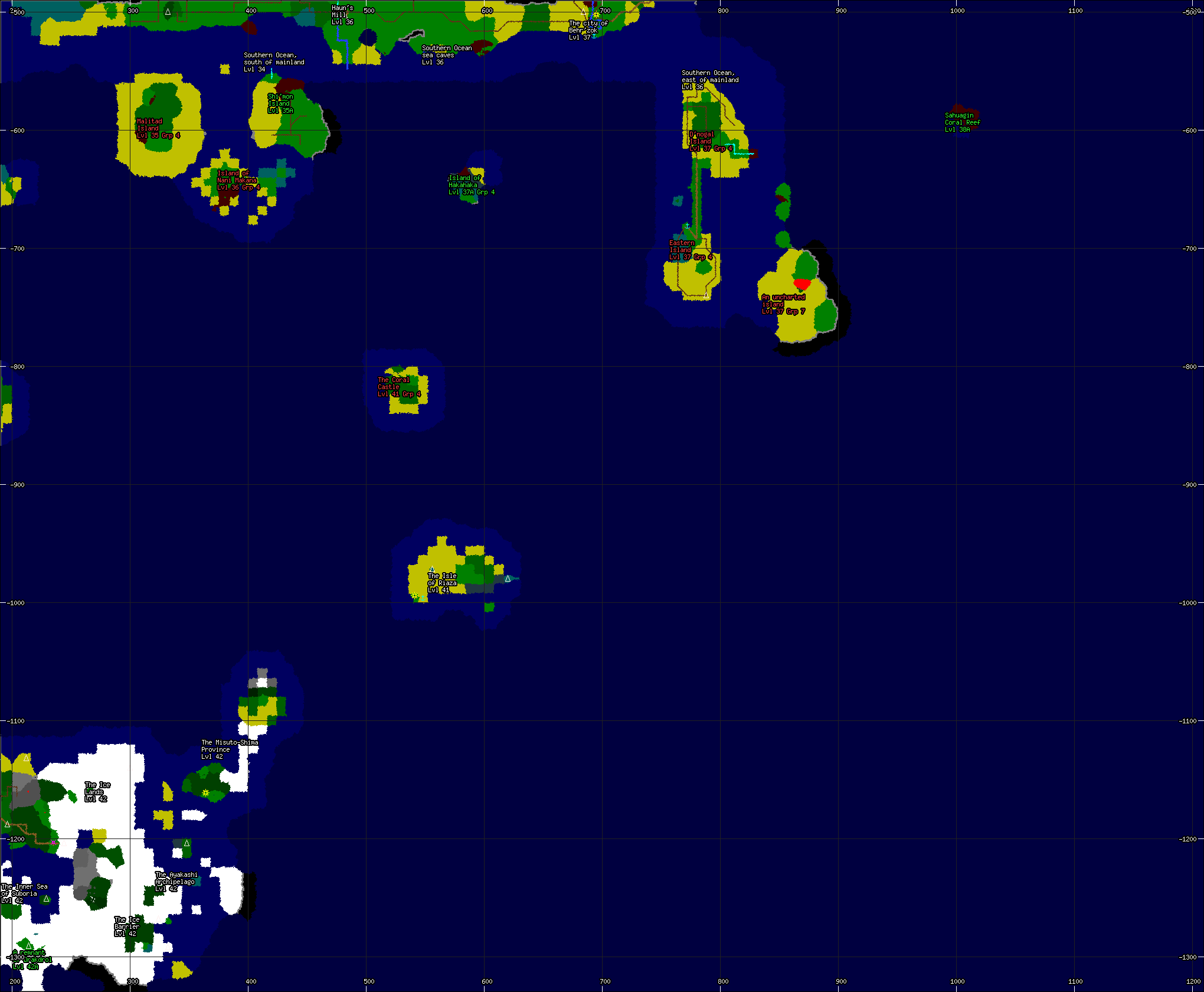
Mainland Continent Trade Route Maps
These maps of the mainland were assembled from various pieces of other maps over the years and has been painstakingly verified by members of the Ralnoth Merchant's Guild with the help of the Cartographers Guild.The trade routes are geographically correct, but focus more on roads and rivers than general area layout. For clarity, only general regions and well known landmarks are labeled.
- Alter Aeon Mainland - Northwest Trade Route Map
- Alter Aeon Mainland - Northern Trade Route Map
- Alter Aeon Mainland - Northeast Trade Route Map
- Alter Aeon Mainland - Western Trade Route Map
- Alter Aeon Mainland - Central Trade Route Map
- Alter Aeon Mainland - Eastern Trade Route Map
- Alter Aeon Mainland - Southwest Trade Route Map
- Alter Aeon Mainland - Southern Trade Route Map
- Alter Aeon Mainland - Southeast Combine Trade Route Map
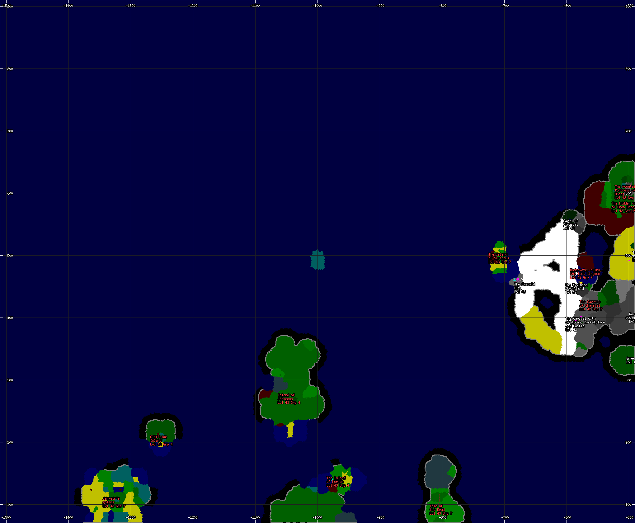
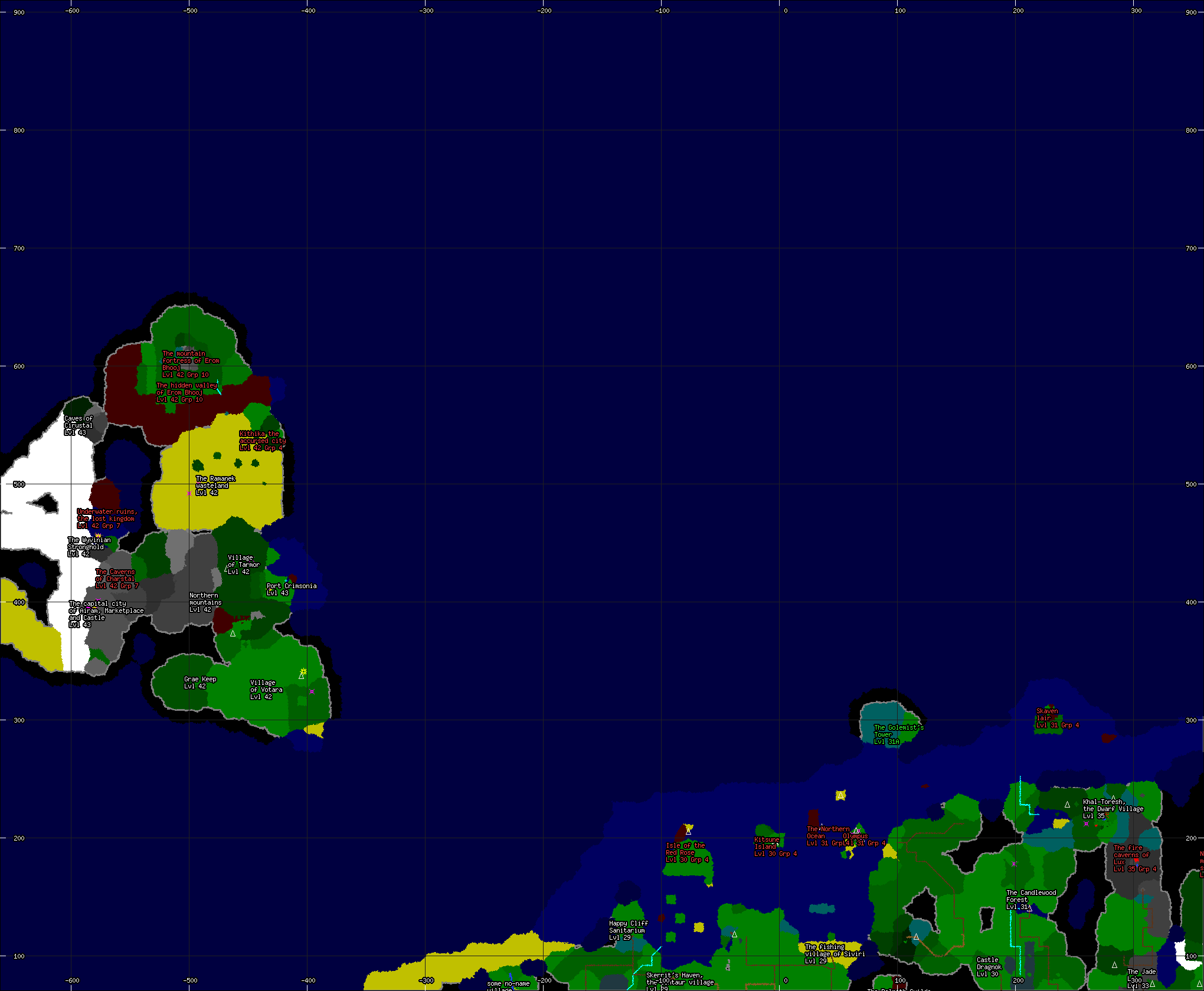
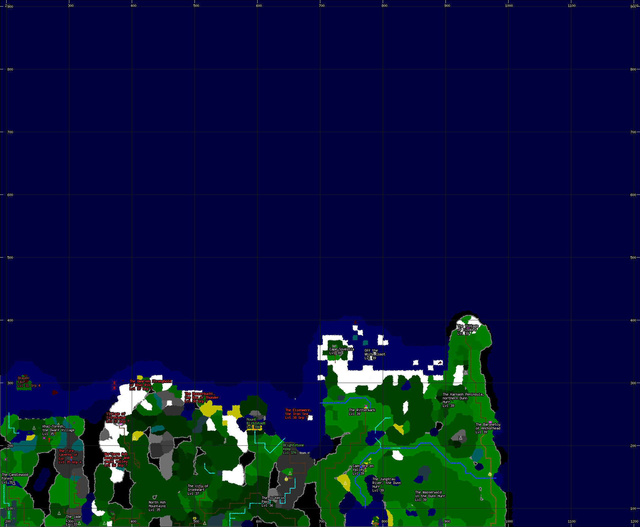
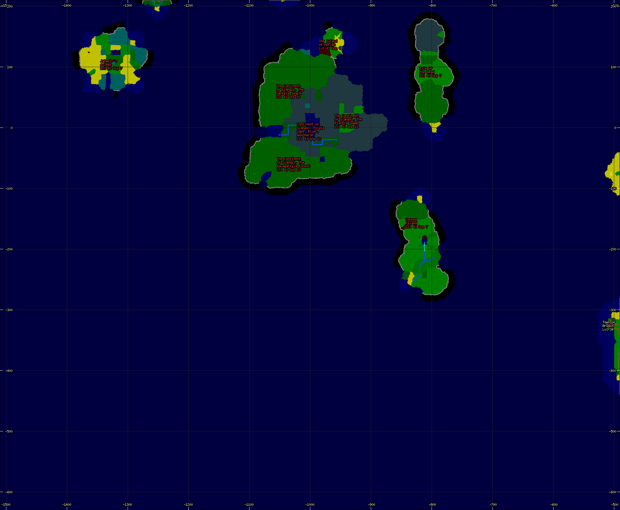
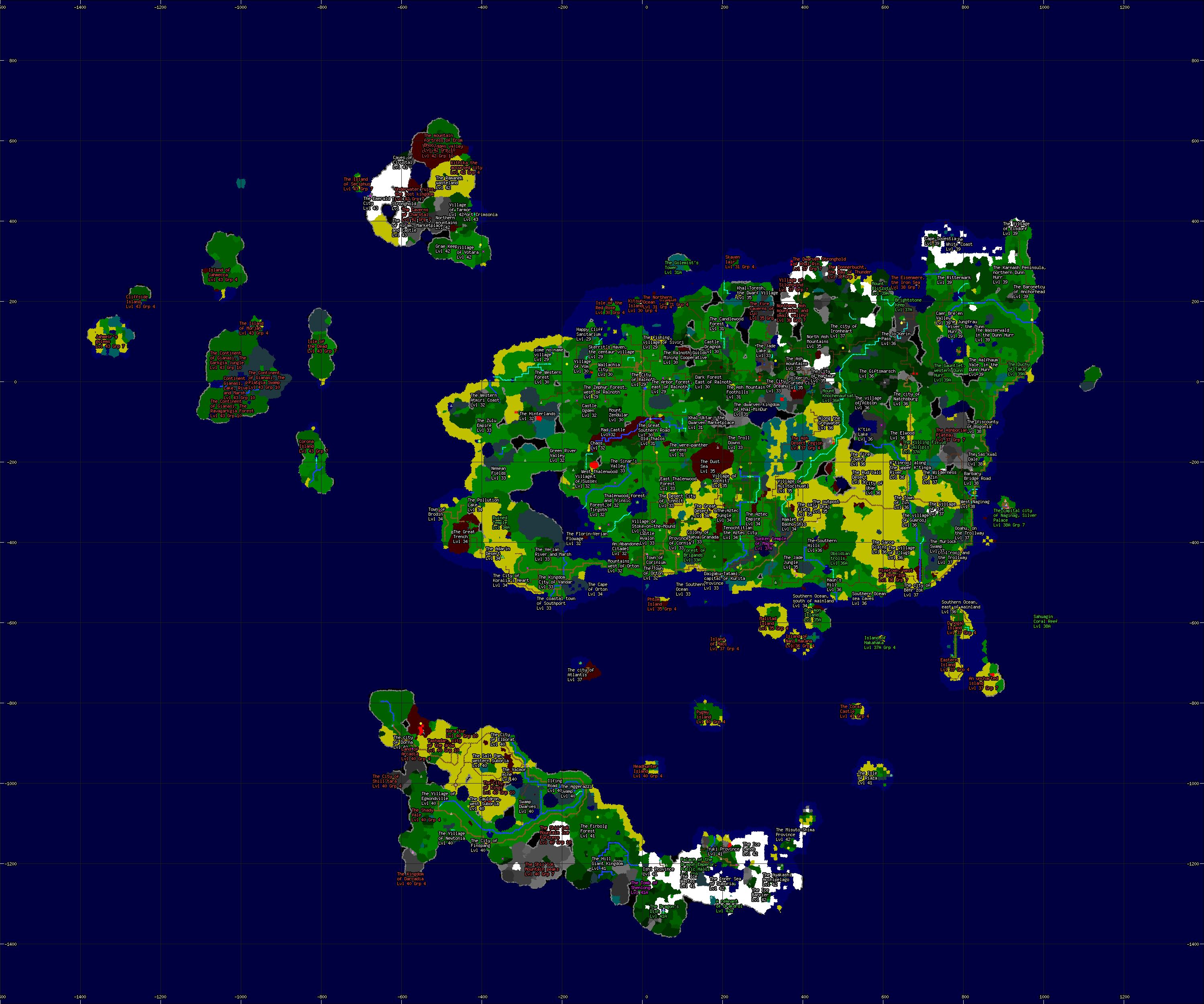
World Maps - All Areas, Trade Routes, and Cities
Maps From Private Collections
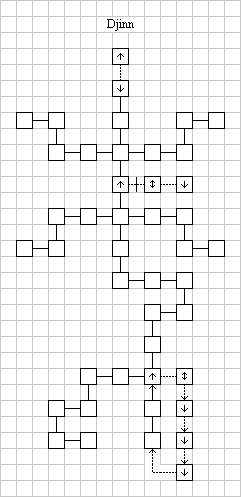
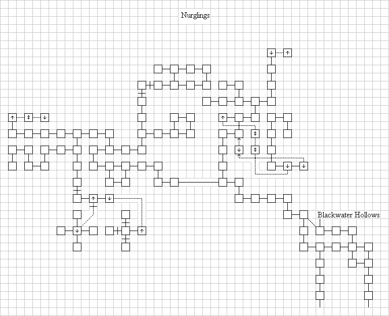
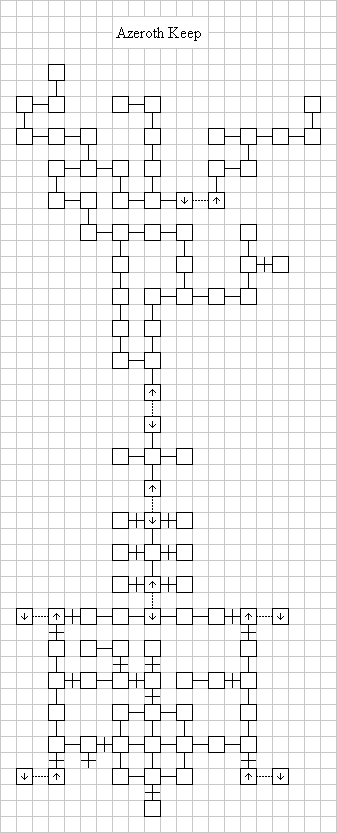
The following are pages from the exploration notes of the renowned explorer Woem. These hand drawn pages were given to the various guilds recently and have not yet been converted into more conventional forms. Additionally, some of the notes are cryptic, though users of the maps claim they are accurate.Maps for the Island of Archais:
- Level 15-25: The Djinni School
- Level 15-25: The Nurgling Mound and Swamp
- Level 20-30: Azeroth Keep
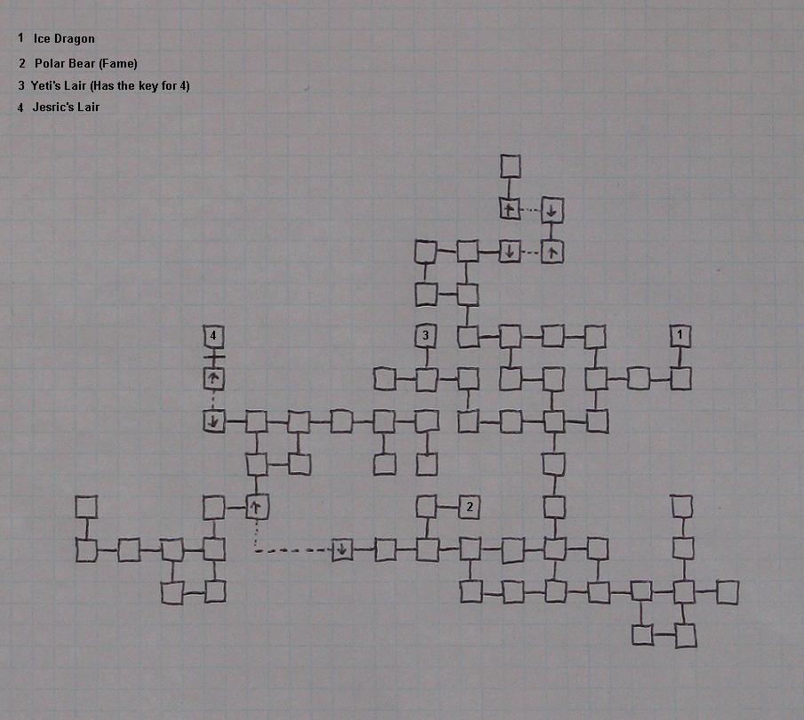
- Level 15-30: The Ice Plane
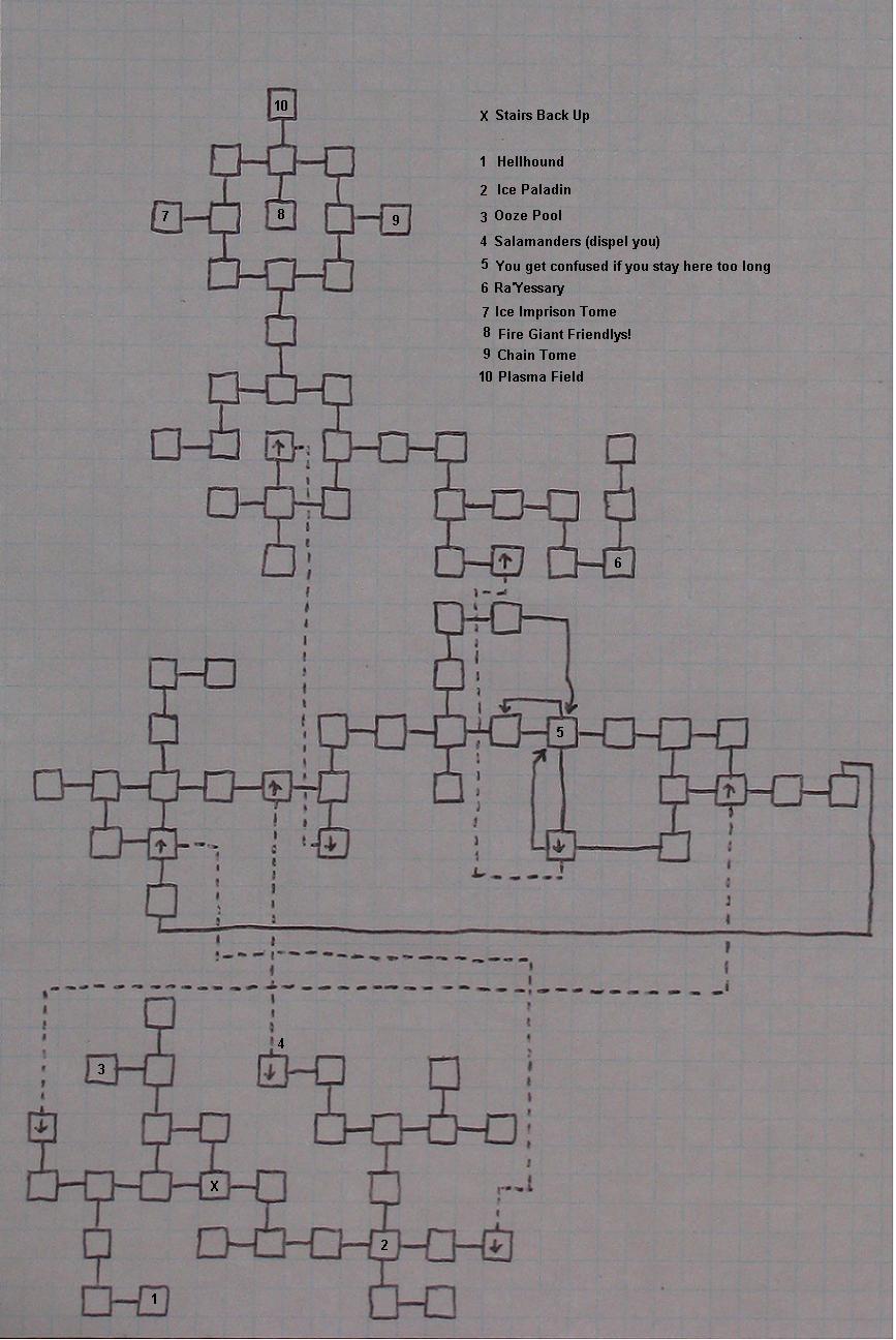
- Level 25-30: The Fire Plane
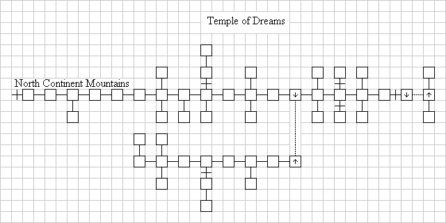
- Level 10-25: The Monastery of Dreams
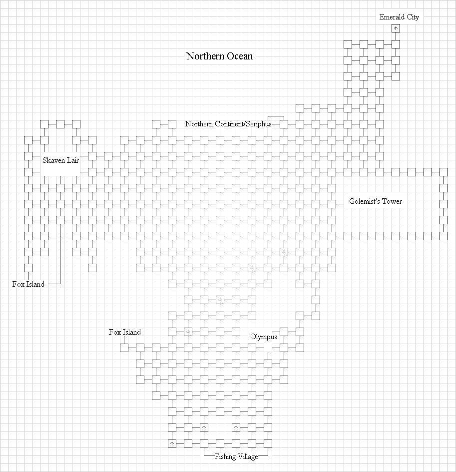
- Level 15-25: The Northern Ocean
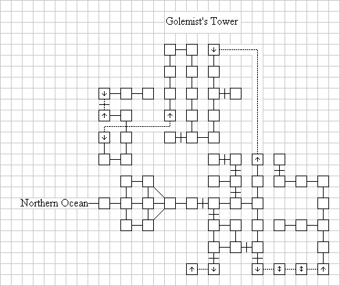
- Level 25-30: The Golemists Tower
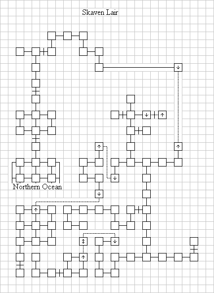
- Level 25-30: The Skaven Lair
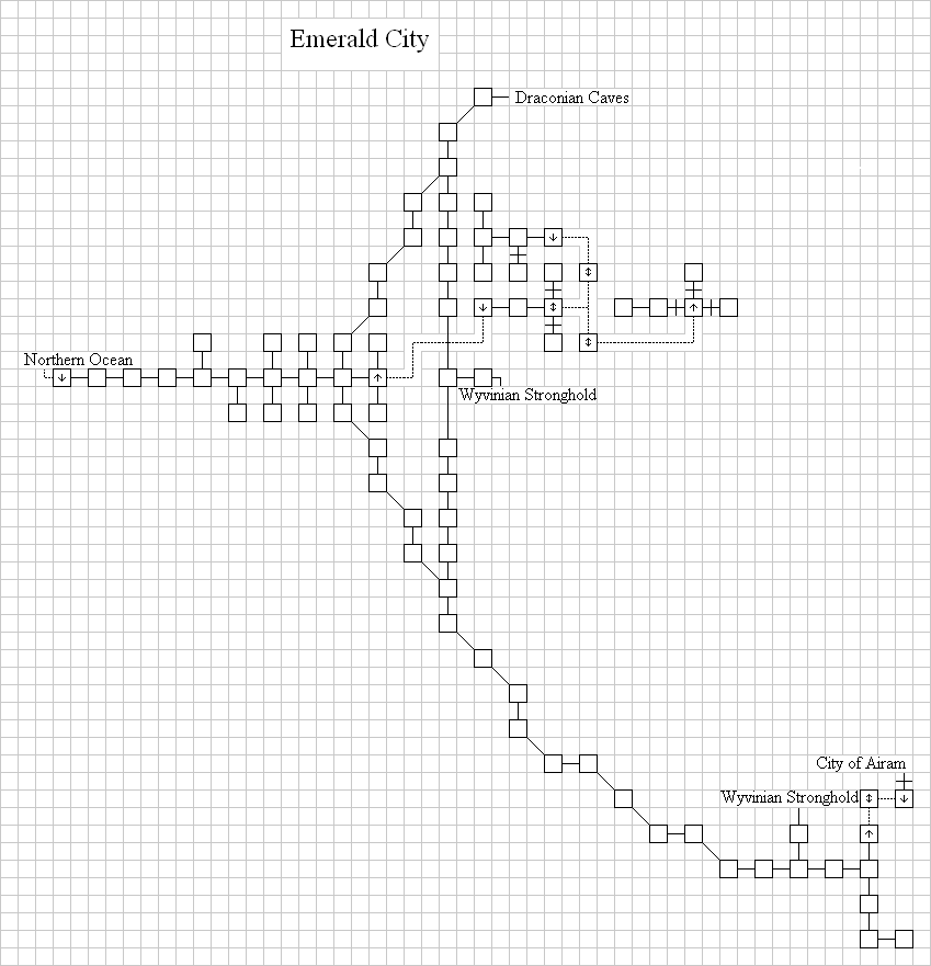
- Level 25-35: The Emerald City
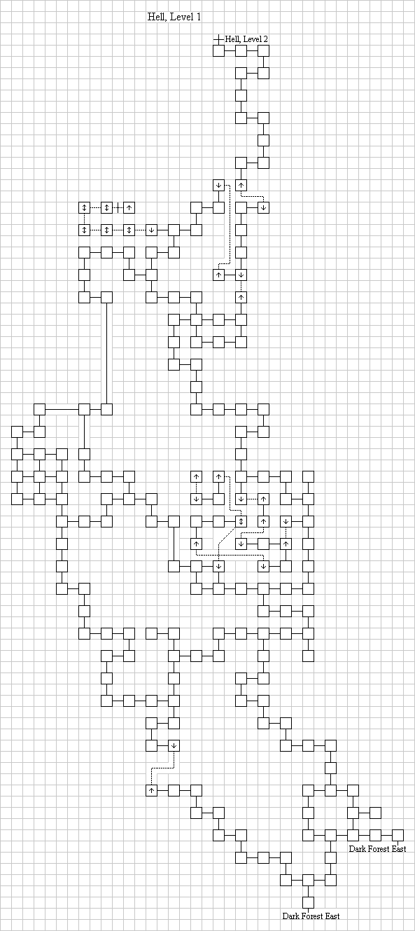
- Level 18-28: Hell, Level 1
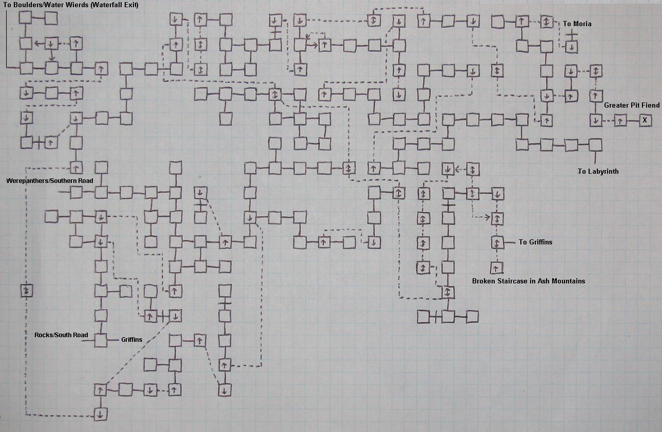
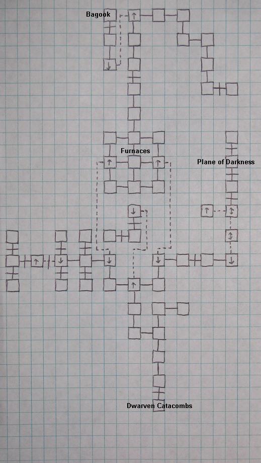
- Level 15-30: The Dwarven Catacombs
- Level 28-35: The Dwarven Catacombs - Moria
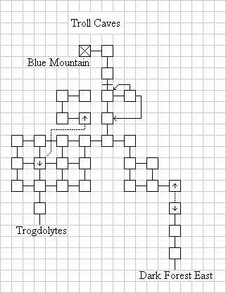
- Level 24-30: Troll Caves
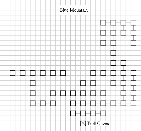
- Level 24-30: Blue Mountain
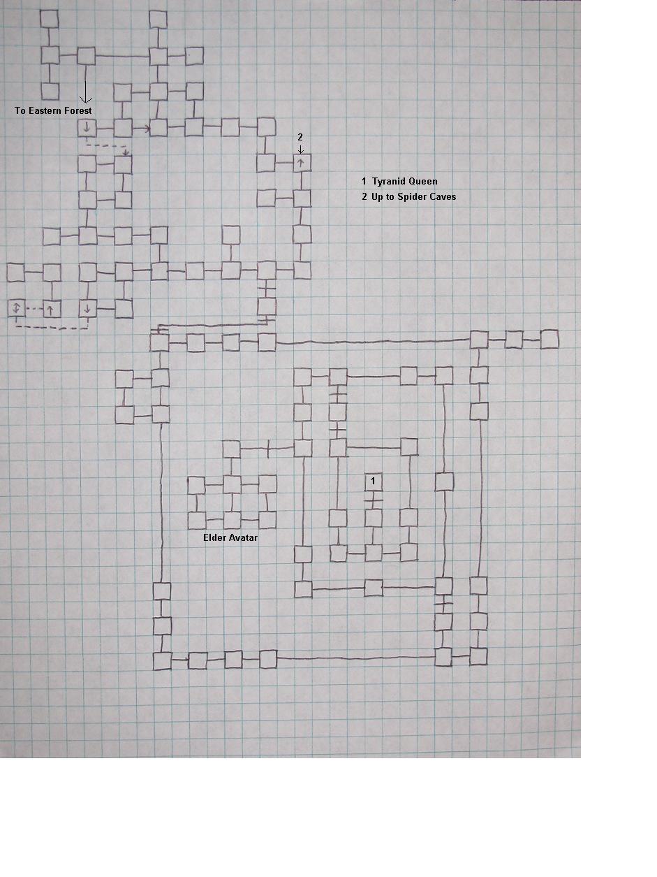
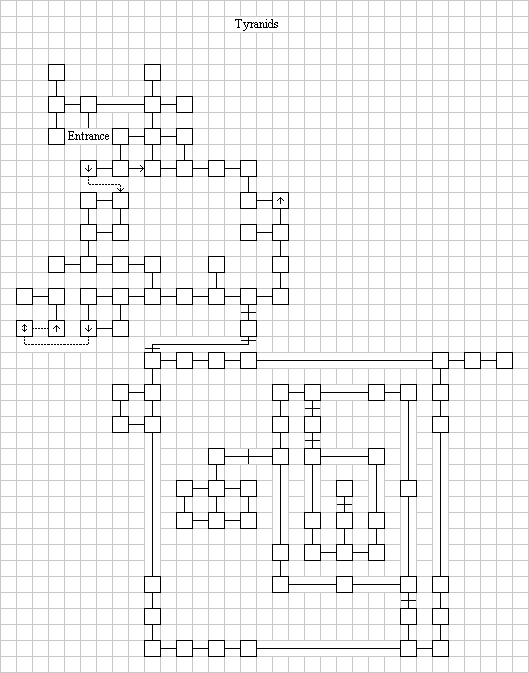
- Level 25-30: Tyranids - version 1
- Level 25-30: Tyranids - version 2
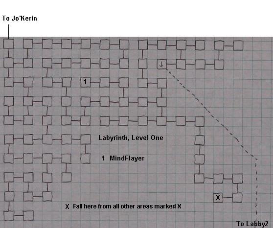
- Level 25-30: The Labyrinth outside Jo'Kerin, Level 1
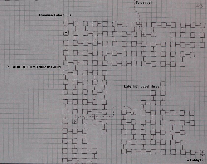
- Level 27-31: The Labyrinth, Levels 2 and 3
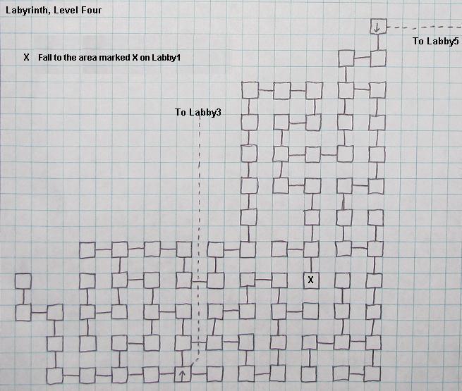
- Level 28-31: The Labyrinth, Level 4
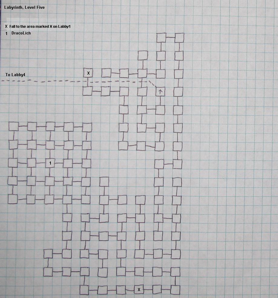
- Level 28-31: The Labyrinth, Level 5
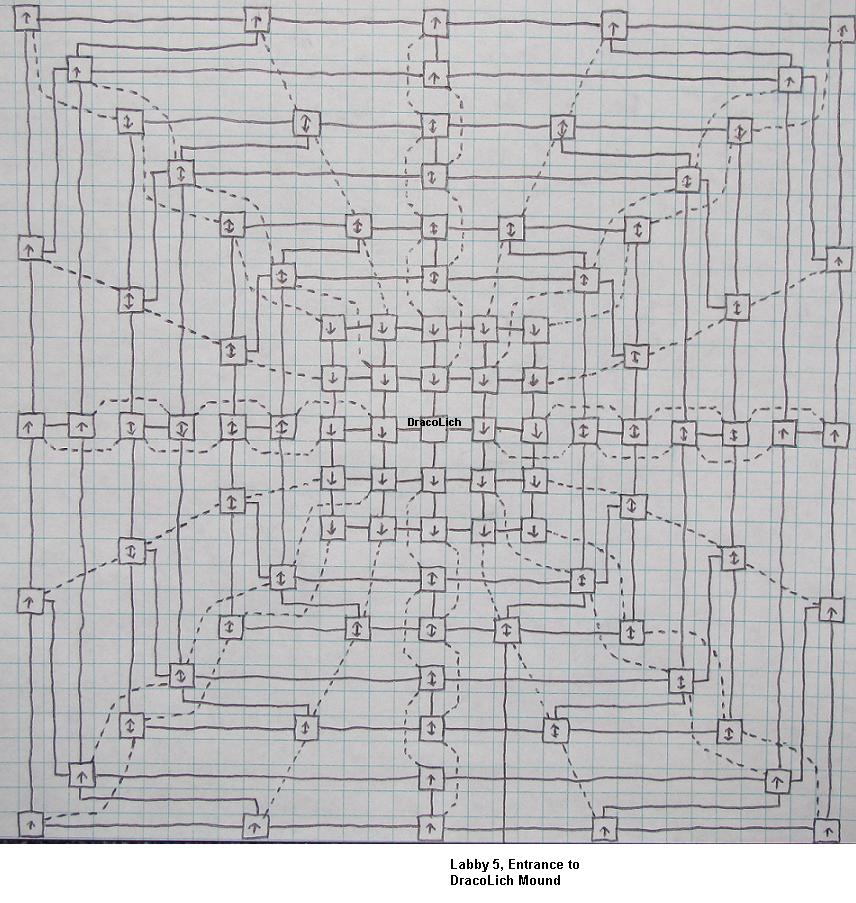
- Level 30-35: The Dracolich Mound
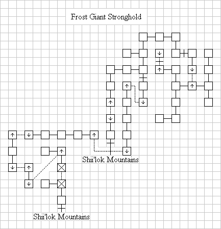
- Level 28-35: Frost Giant Stronghold
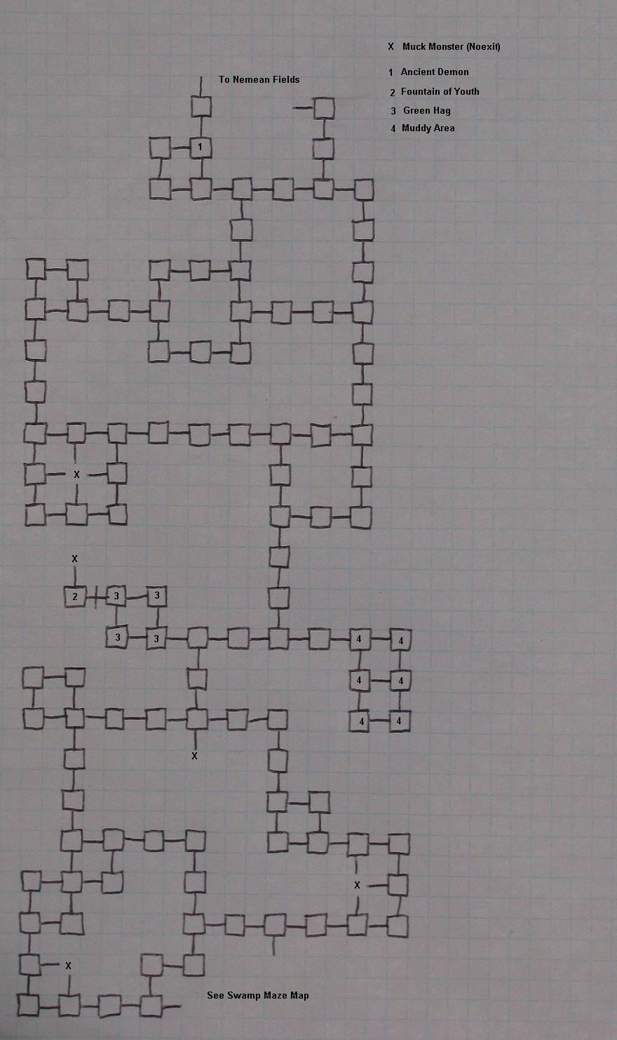
- Level 28-35: The Aggerazzi Swamp
ASCII Art Maps In-Game
A number of ASCII-art maps of various areas in the game are provided courtesy of the Alter Aeon Cartographers Guild. While lacking the detail of high resolution maps, they serve as a handy reference for some players. All of these maps are available for sale in-game from the Cartographers Guild in downtown Ralnoth.Maps From the Pantheon of Gods
Here are a handful of maps created by the Gods of Alter Aeon, given to select few priests and mortals and eventually acquired by the Cartographers Guild. As with all godly artifacts, these maps may be extremely useful, useless, or even dangerous to adventurers; Where possible, translations and interperetations have been added to improve clarity.USE AT YOUR OWN RISK!
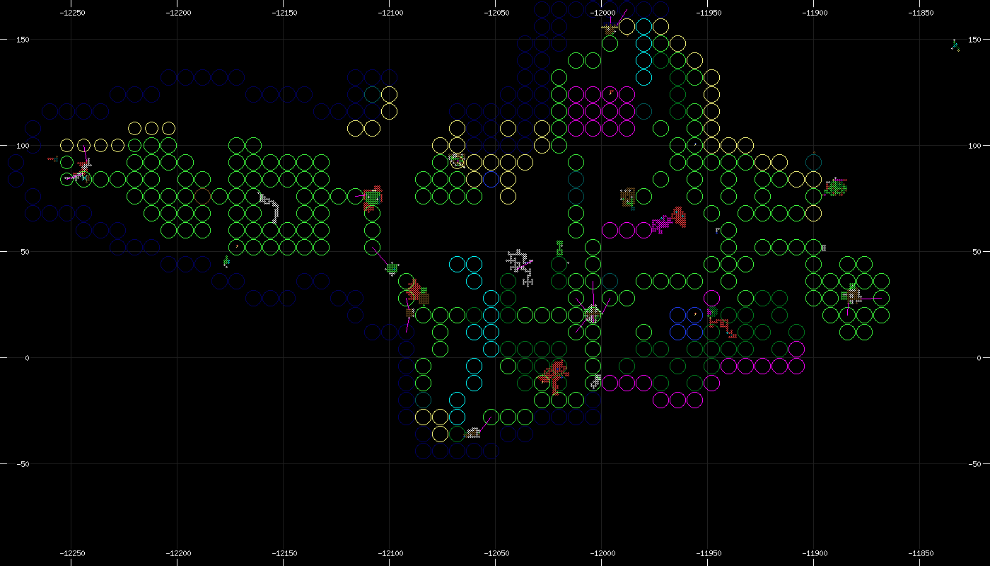
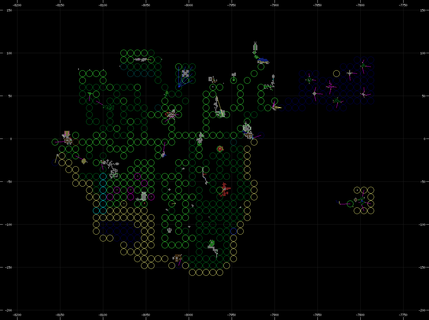
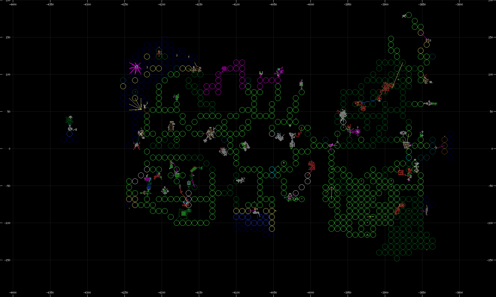
This group of God maps, known only as "Room Maps", are difficult to decipher but appear to give a distorted yet very detailed view of the areas they center on. Different colors indicate water or other unusual terrain types.
It is unclear why they are labelled "Room Maps", and all three maps came with no other identifying marks or indication of what areas they represented. The island of Sloe was was quickly understood but the Kordan and Archais maps took substantially longer due to lack of exploration.
As with all godly artifacts, trust these maps at your own risk.